Find the best spot to fly from.
Draw the shot you want to film on a 3D map. Spot FPV checks the terrain, the trees and your radio, then shows where to stand so your video and control link hold along the whole line.
Android app. The trial needs no account and no card.
Same shot, different spot
Hills cut your link long before the drone is out of sight. Drag the pilot along the valley and watch what happens to each point of the shot.
The coloured line is the drone's path. Drag the pilot, or select it and use the arrow keys.
A simplified slice of a river valley with a spur in the bend. The app does this in 3D, on real terrain and trees, for every place you could stand.
How it works
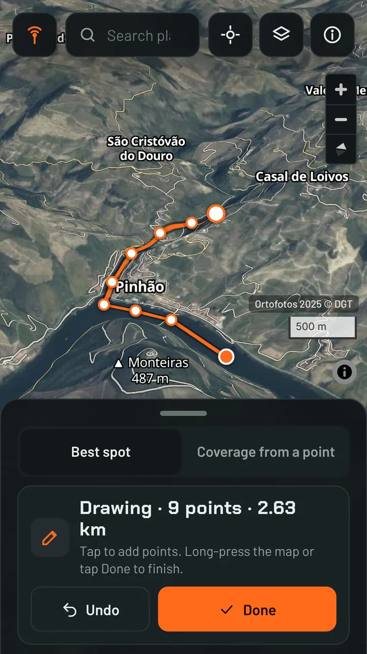
Draw the shot
Tap points on the 3D map along the line you want to film, at the height you'll fly. You can also import a GPX or KML line.
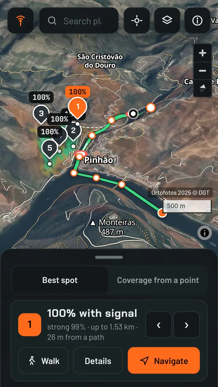
Find the best spot
Spot FPV tests every place you could stand and ranks them by how much of your line keeps a solid link.
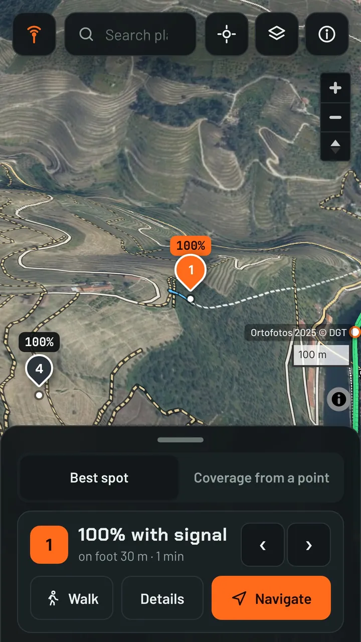
Walk there and fly
Follow the walking route to the spot. Save the area at home and the map, terrain and analysis keep working with no signal.
What the colours mean
- Green
A solid link, with at least your safety margin (6 dB by default).
- Yellow
A weak link, or the signal goes through trees. The image may break up.
- Red
Signal lost. Don't fly that stretch from where you're standing.
Built on real terrain
Official LiDAR
Where a country publishes its terrain model, Spot FPV loads it by itself: France, Spain, the Netherlands, Belgium, Luxembourg, England, Switzerland, Norway, Czechia, Estonia, Malta, Italy and several German and Austrian regions. In Portugal, add the free DGT LiDAR files.
Real tree heights
Tree heights at 1 m resolution from Meta and WRI. The signal loses strength through foliage instead of hitting a wall.
Your radio
Presets for DJI O4 and O4 Pro, DJI O3, Walksnail, HDZero, and ELRS at 2.4 GHz and 868 MHz. The weaker of video and control decides.
Works offline
Save the area at home on Wi-Fi. In the field the map, terrain, paths, trees and the analysis work without signal.
One pass, everything included
Annual pass
€19.99for 12 months
Founder price for the first 100 passes. After that the pass costs €24.99, and founders keep €19.99 when they renew.
- Every feature, on one phone at a time. Move it to a new phone whenever you want.
- No automatic renewal. We email you before your pass ends.
- Pay by card or MB WAY.
- Changed your mind? Ask for a refund within 14 days of paying.
Install on Android
- Download the app file (APK) to your phone.
- Open it. If Android asks, allow installs from your browser.
- Open Spot FPV. Your 14-day trial starts right away.
- After you buy, tap Activate in the app and enter the email you paid with. We send you a 6-digit code.
SHA-256 checksum:
Spot FPV isn't on Google Play yet. Every version is signed with the same key, so updates install over the previous one.
Questions
Is Spot FPV on Google Play?
Not yet. For now you install it from this site. Passes bought here will keep working when it reaches Google Play.
Does it work on iPhone?
Not yet. Spot FPV runs on Android phones and tablets.
Do I need mobile data in the field?
No. Save the area at home on Wi-Fi and everything works offline there. Without a saved area, the map and terrain load over mobile data.
Can I use my pass on two phones?
One phone at a time. When you activate a new phone, the old one is switched off the next time it goes online.
What happens when my pass ends?
We email you 14 days before. Renew on this site and the new 12 months are added to the end of your current pass. Nothing is charged automatically.
Does it guarantee I won't lose signal?
No. It's a planning tool based on models of the terrain and the trees. Rocks, poles and interference aren't in the data, so always check on site and follow your aviation authority's rules.
Which countries does it cover?
The whole world, with terrain at about 30 m. With official LiDAR the detail goes down to about 2 m, in the countries listed above and anywhere you import your own files.
How do refunds work?
Write to support@spotfpv.com within 14 days of paying and we refund you in full. Your pass is switched off.